


San Lorenzo

gildascb
User
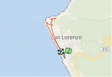

Length
3.8 km

Max alt
88 m

Uphill gradient
95 m
Km-Effort
5.1 km

Min alt
0 m

Downhill gradient
95 m
Boucle
Yes
Creation date :
2020-10-09 21:56:06.263
Updated on :
2021-08-12 15:50:46.263
1h35
Difficulty : Very easy

FREE GPS app for hiking
 SityTrail
IGN / Geographical institutes
SityTrail World
The world is yours!
About
Trail Walking of 3.8 km to be discovered at Manabí, Manta, San Lorenzo. This trail is proposed by gildascb.
Description
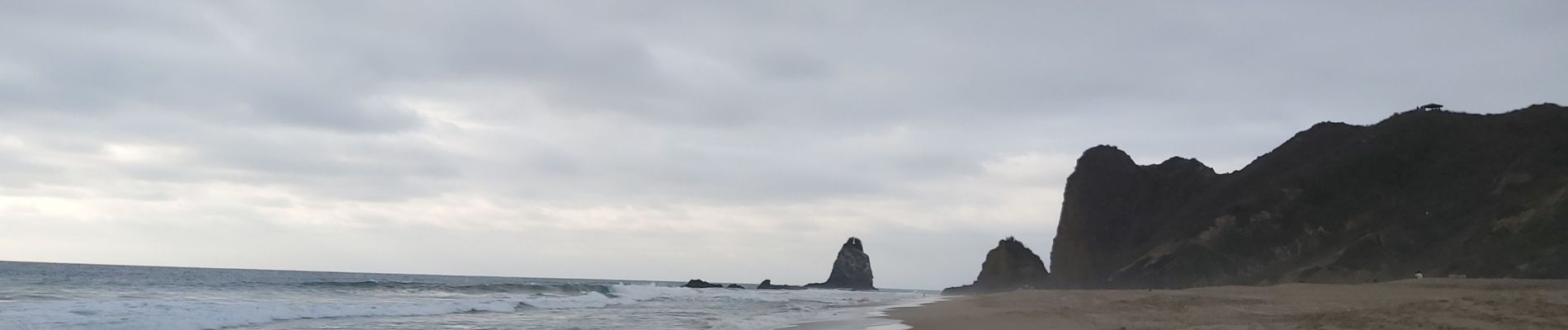
Pueblo pequeño y muy tranquilo en la costa. Un camino a lo largo de la playa le permite subir unas escaleras en un cerro que ofrece una vista espectacular sobre la playa.
Nota: Lugar de anidación de tortugas.
Photos


Positioning
Country:
Ecuador
Region :
Manabí
Department/Province :
Manta
Municipality :
San Lorenzo
Location:
Unknown
Start:(Dec)
Start:(UTM)
510282 ; 9881769 (17M) S.
Comments
Trails nearby